-40%
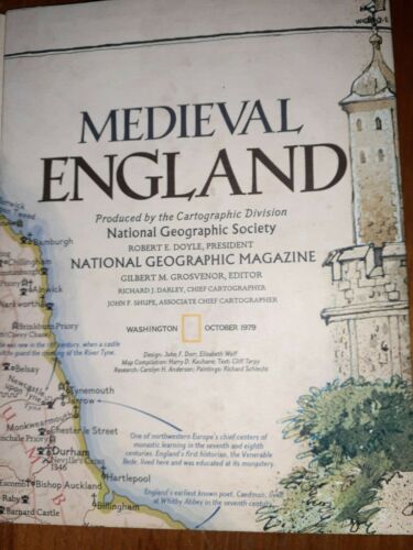
MEDIEVAL ENGLAND British Isles National Geographic Map Poster 1979
$ 2.5
- Description
- Size Guide
Description
1979 MEDIEVAL ENGLAND BRITISH ISLES – National Geographic Map PosterThe paper has been printed to appear aged. The reverse-side is a classic National Geographic political map of modern England, Ireland, Scotland, Wales, and Northern Ireland.
Overall the map is in excellent condition and really looks as if it hasn't been handled or used, there are no pin marks and the map still folds into it's crisp original fold marks.
The map is approximately 28” x 30.
I try to capture true condition in the images but feel free to reach out if you have any questions.
Thank you for looking.
**I take pride in the care I give to packing so that the item arrives to you in excellent condition**
